
Create custom maps that help visualize vital spatial information for emergency planning and response. Design maps with multiple layers (cartographic map, satellite view, street view, etc.) and overlay your existing data.
Join the Ranks: Startups to Enterprises Trust Our Routing and Navigation Platform.


NextBillion.ai’s APIs and SDKs Account for the Challenges and Complexities of Emergency and Disaster Management.

Custom Maps
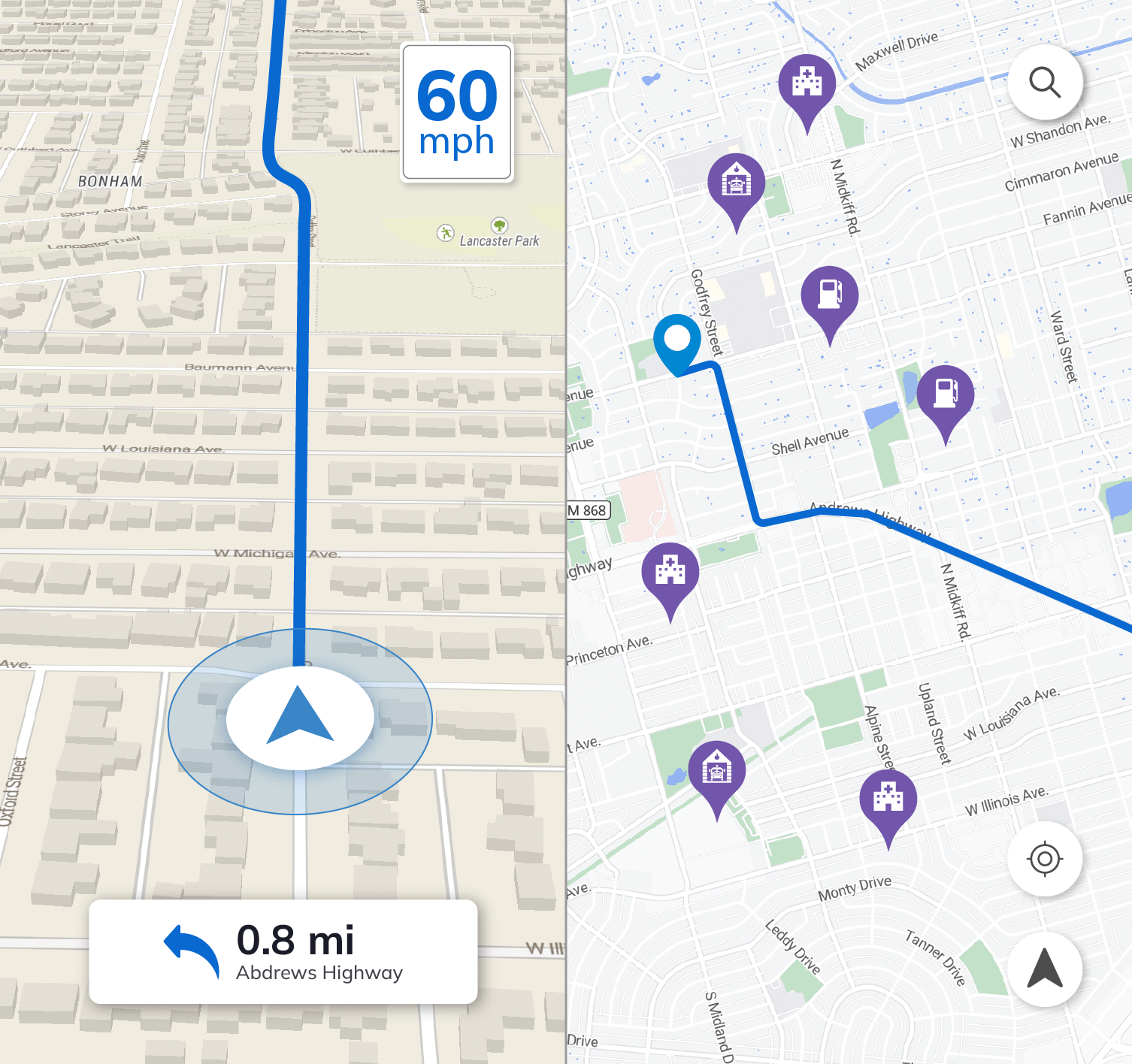
Create custom maps based on local terrain, with features like street view and satellite view

Route Editor
Implement custom restrictions and permissions to facilitate movement of emergency vehicles

Fresh GIS Data
Revise risk assessment and management with updated location information to ensure continual protection

Offline Maps
Enable offline maps synced with the latest updates for uninterrupted access and rapid response in emergencies
A Suite of Tools to Build Your Disaster Management Solution
Create custom maps optimized for emergency responders
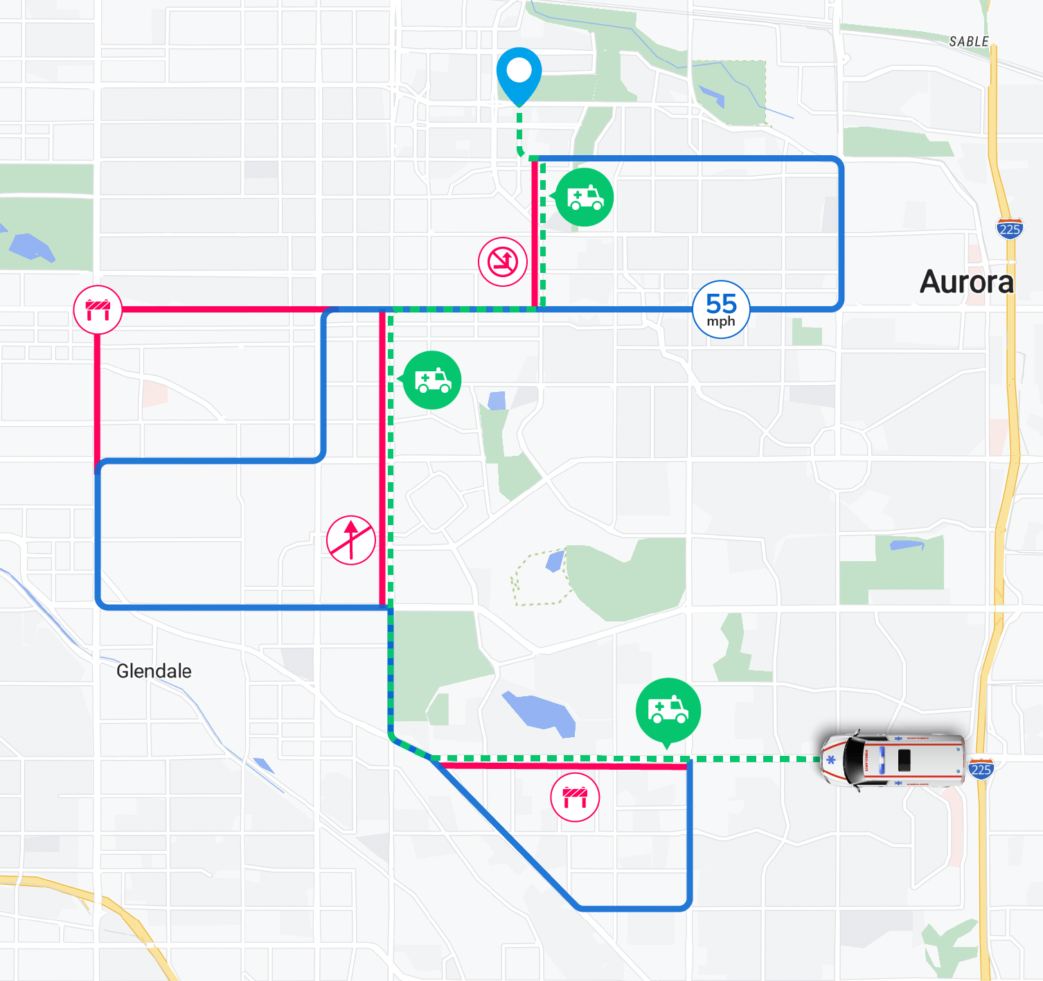
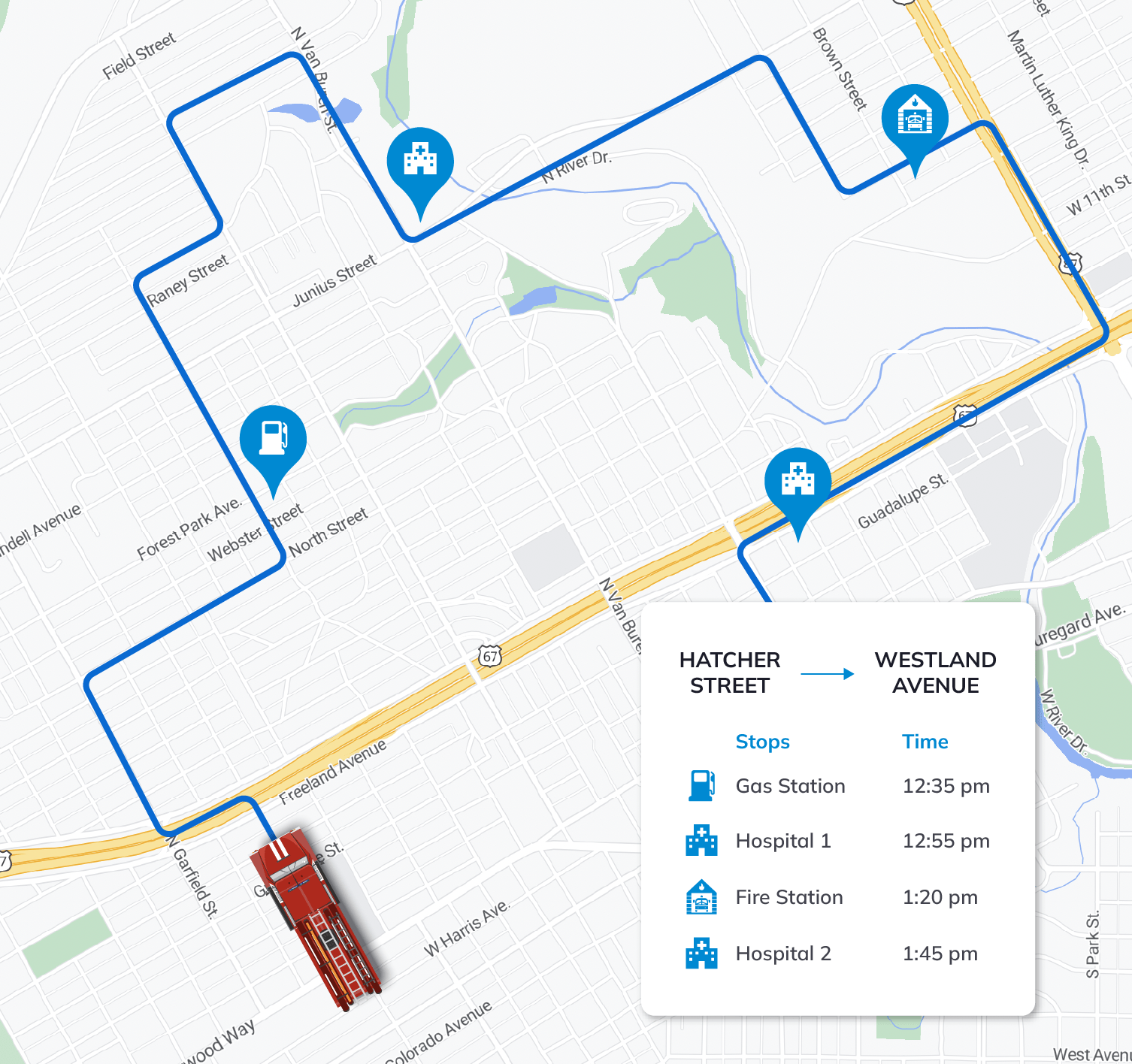
Enable special routes for emergency vehicles
NextBillion.ai’s route editor improves response time significantly by allowing special permissions to emergency vehicles to enter restricted zones, use pedestrian walking areas. Create restricted zones and area for other public vehicles.
Get emergency-vehicle-optimized ETAs and routes in offline maps
NextBillion.ai’s intelligent algorithms generate highly accurate ETAs and optimal routes for custom emergency vehicles based on vehicle attributes — in real time or in advance.
Map tools allow for incorporation of road closures, entry/exit points, tolls, stops and other nuances while calculating the ETAs.
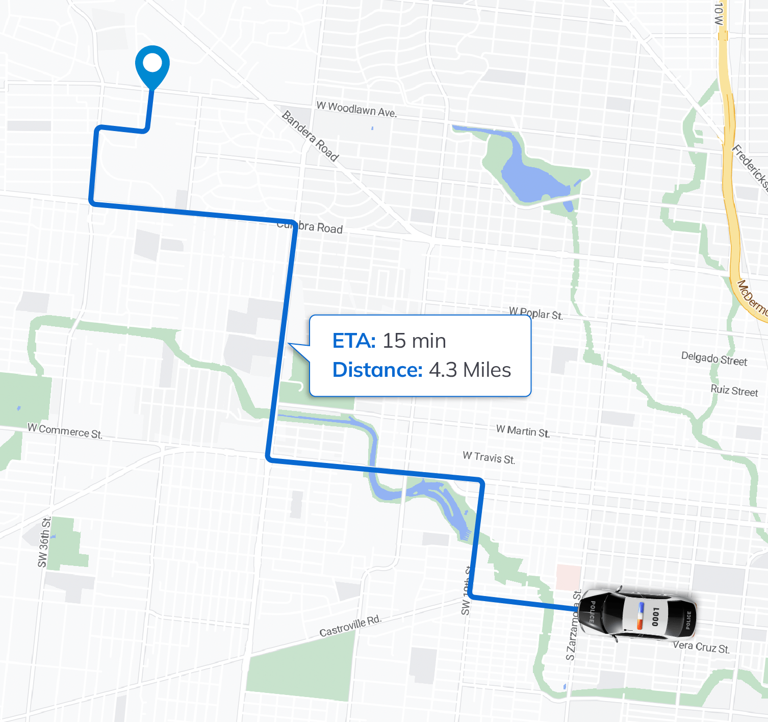
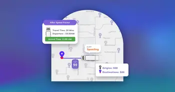
Optimize response allocation and dispatch
Execute data-driven allocation of response units that takes into account traffic conditions, unit availability and responder capabilities. Optimize dispatch for incident response in real time and get accurate estimated arrival times with our Directions, Distance Matrix and Snap-to-Road APIs.
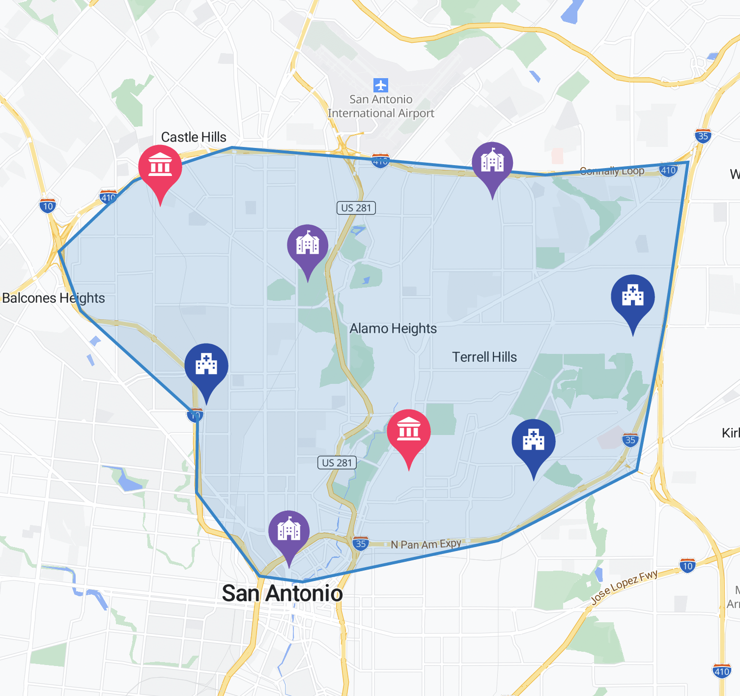
Activate geofence alerts for improved response
Geofence alerts enable the automatic detection of any tracked asset (like a vehicle), or calls made from cellular devices, inside a defined geofence boundary. They equip the appropriate emergency responders with accurate location information in real time for quick response.
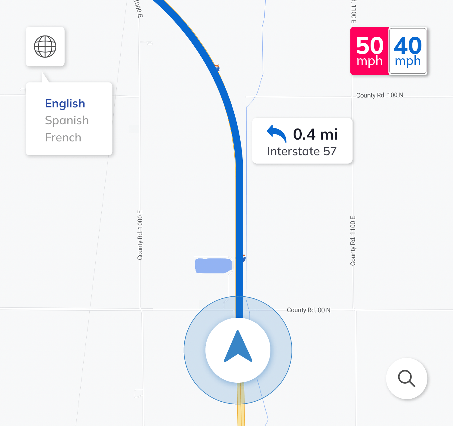
Multi-language support
NextBillion.ai’s SDKs support multiple languages so you can localize your app’s user experience. Display road labels, POIs and driving instructions in the relevant local languages for your users.
The Complete Package for Emergency Responders


Our Customers Love Us

NextBillion.ai solves the problem of providing a high-performance mapping platform at scale. We generate efficient delivery schedules in real time for hundreds of vehicles, so distance calculations need to be fast and reliable. NextBillion.ai’s Distance Matrix service meets and exceeds this demand.